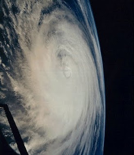
Coast Guard warns mariners of the danger of approaching Tropical Storm Andrea
WILMINGTON, N.C. – The Coast Guard encourages boaters to stay off the water Friday due to the approach of Tropical Storm Andrea and the storms impact on on the coastal Carolina area.
Adverse weather effects generated by a tropical storm or hurricane can cover an area hundreds of miles wide. Recreational boaters and members of the maritime industry who fall outside of the direct path of the storm are advised to be cognizant of dangerous weather conditions and appropriate precautions to stay safe and minimize damage.
North Carolina boaters, including those in Pamlico Sound, Albemarle Sound and connecting waterways, are urged to secure their vessels and any emergency positioning indicator radio beacons. Those who heed the warnings of the Coast Guard and local law enforcement authorities will keep themselves and first responders out of danger.
Boaters should take the precautions necessary to ensure their personal safety due to strong, gusting winds associated with the outer weather bands of tropical storms. Heavy seas, significant rain and damaging winds may accompany and present serious dangers to boaters. Rescue and assistance by the Coast Guard and other agencies may be degraded as the storm approaches.
Drawbridges along the coast may deviate from normal operating procedures prior to a storm. They are generally authorized to remain closed up to eight hours prior to the approach of gale force winds of 34 knots or greater and whenever an evacuation is ordered. Because of the uncertainty of weather movements and related bridge closures, mariners should seek passage through drawbridges well in advance of the arrival of gale force winds. When in doubt, check in advance with the Coast Guard Sector North Carolina command center or with a local Coast Guard station.
Here are a few tips to help mariners protect themselves, their families and their vessels:
•If local authorities issue an evacuation notice, take heed and know the evacuation routes.
•Secure electronic position indicating radio beacons. If unsecured, EPIRBS can break free from a boat and trigger an emergency signal to the Coast Guard.
•Do not go out to sea in a recreational boat when a tropical system is approaching.
•Contact local marinas to ask for advice about securing a vessel. Marina operators are knowledgeable and can advise mariners on the best methods for securing a boat.
•Ensure boating gear is properly stowed or tied down to avoid causing unnecessary searches by the Coast Guard and other first responders. Life jackets, life rafts and small non-powered vessels are some examples of boating equipment often found adrift following severe weather.
•Take action now. The effects of a tropical system can be felt well in advance of the storm itself and can prevent the safe completion of preparations.
After the storm passes, check with local authorities before entering any storm-damaged area. Boat owners should not place themselves in danger in order to survey damage.
•Do not try to reach a boat that has been forced into the water and is surrounded by debris. Wait until authorities have made safe access available.
•Do not try to board a partially sunken boat; seek salvage assistance from a professional.
•Stay clear of beaches. Even the best swimmers can fall victim to the strong waves and rip currents. Swimmers are urged to stay clear of beaches until local officials say the water is safe.
Family friendly and striving to be a worthy choice for your Internet browsing. Comments and material submissions welcome: tkforppe@yahoo.com . Pocomoke City-- an All American City And The Friendliest Town On The Eastern Shore.
Showing posts with label tropical storms. Show all posts
Showing posts with label tropical storms. Show all posts
Friday, June 7, 2013
Friday, May 28, 2010
NOAA Predictions For Storms This Season

The upcoming Atlantic hurricane season will have between 14 to 23 tropical storms, including up to seven major hurricanes, the U.S. government predicted Thursday.
The National Oceanic and Atmospheric Administration predicted that eight to 14 hurricanes would form. Scientists forecast that three to seven of those hurricanes would be major storms that reach Category 3 or higher -- meaning they bring sustained winds of at least 111 mph.
"If this outlook holds true, this season could be one of the more active on record," NOAA administrator Jane Lubchenco said in a statement. "The greater likelihood of storms brings an increased risk of a landfall. In short, we urge everyone to be prepared."
The forecast is based on the weakening of El Nino. The Pacific Ocean phenomenon creates strong wind shear that weakens Atlantic storms.
No hurricanes hit the United States last year. Hurricane Ida hit Nicaragua as a Category 1 storm last November.
The Atlantic hurricane season begins Tuesday and runs through Nov. 30.
Subscribe to:
Posts (Atom)
